A few years ago, when I got a call from a mining client asking if our underground wireless network could help them track high-value drill bits and custom pipeline components 800 meters below the surface, I’ll admit I didn’t see it coming. At the time, our team was known for building and maintaining robust, low-latency underground communication systems for remote sites—mostly for voice calls and sensor data, like seismic readings and ventilation flow. We’d spent years troubleshooting dead zones in abandoned mine tunnels, refining signal propagation through compacted rock, and making sure our hardware could handle temperatures that swing from -10°C to 45°C without dropping a connection. Asset tracking felt like a side project, something that might work for surface warehouses, not a space where GPS signals are just a faint static blip and tag batteries die in weeks from constant rock interference. But that client wasn’t the only one asking. Over the next two years, we started getting the same question from construction crews digging deep metro tunnels, oil and gas teams working offshore platforms that sit below sea level, even a few agricultural operations with deep irrigation networks. So we dug into the data, ran our own tests, and built out a tracking module for our underground network. Now, we’re regularly answering: Can an underground net be used for asset tracking? The short answer is yes—but it’s not the same as slapping a Bluetooth tag on a forklift. Let’s break down why it works, what makes it different from surface tracking, and why it’s actually more reliable than most people think. Underground Net
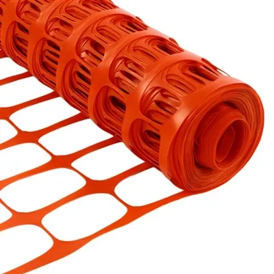
First, I need to clear up the biggest myth around underground asset tracking: that you need GPS. Anyone who’s ever walked into a parking garage or a basement and watched their phone lose location services knows GPS doesn’t work 10 meters below ground, let alone 1,000. The issue is radio frequency (RF) absorption—radio waves bounce off dense materials like rock, concrete, and salt, and their signal strength drops exponentially the deeper you go. Traditional RFID tags, the ones used for retail inventory, only work a few meters away, and their small antennas can’t generate enough power to punch through compacted earth. Bluetooth Low Energy (BLE) tags have a similar range, and their batteries don’t last long when you’re trying to push a signal through rock. Satellite-based tags? They might work in very shallow tunnels, but any depth beyond 50 meters and the signal doesn’t penetrate. That’s where our underground net comes in.
Our network is built using a mesh of rugged access points (APs) that we install every 300 to 500 meters along a tunnel or excavation site. These APs aren’t the flat, boxy ones you see in an office—they’re reinforced with powder-coated steel, have built-in heat and humidity regulation, and use a frequency band tuned specifically for underground RF propagation: 900 MHz. Lower frequencies travel farther through dense materials than higher ones, which is why AM radio reaches farther than FM. That 900 MHz signal can travel up to 100 meters between APs in dry rock, and even 50 meters in wet, clay-heavy ground, without needing a repeater. We also designed the network to handle “shadow zones” common in excavations—when a tunnel turns a corner, or a pile of debris blocks the direct line between two APs, the mesh automatically routes signals around the obstruction instead of dropping them. That’s the core of the underground net’s strength: it’s not a point-to-point system, it’s a flexible, adaptive network that works with the terrain, not against it.
Now, how does that connect to asset tracking? We attach small, low-profile tags (we call them TrackTiles) to any asset that needs monitoring: drill bits, pipeline sections, generator parts, even hard hats for personnel tracking. The TrackTiles don’t send out a constant, powerful signal—they operate on a passive (or semi-passive) system, meaning they only “wake up” when they’re within range of an underground AP. When an AP detects a TrackTile, it logs the tag’s unique ID and the time of the signal, then sends that data back to the network’s central controller on the surface. Using time-difference of arrival (TDOA) and received signal strength indicator (RSSI) calculations, the controller can pinpoint the exact location of the asset within 2 to 5 meters. That’s precise enough to tell you which side of a 1,000-meter long tunnel a drill bit is on, not just the general area.
We tested this system last year at a limestone mine in Western Kentucky that had been losing 12 high-value drill bits a year—each worth around $15,000. The mine’s operators would waste hours digging through old tunnels and waste rock piles to find missing bits, and sometimes they’d have to abandon a whole section of tunnel because they couldn’t locate the bit in time. We installed our APs along the mine’s 1.2-mile main tunnel and attached TrackTiles to all new drill bits. For the first six months, the system worked seamlessly: when a bit was left in a secondary tunnel after a shift, the operators could pull up the asset map on their surface dashboard and see exactly where it was. No more digging blind. They only misplaced one bit that year, and found it in 15 minutes instead of three days. That’s not a win for our network—that’s a win for cutting operational costs by over $100,000 a year for that single client.
But it’s not just mining. We also rolled out a similar system for a metro construction project in Toronto, where crews were tracking pre-fabricated tunnel segments that weighed 50 tons each and were moved through a 1.5-kilometer deep excavation. Before our underground net, crews would use surface GPS to track the segments, but once they were lowered into the tunnel, they lost all location data. Sometimes segments would be stored in temporary pockets for weeks, and the crew would misplace them, leading to delays in tunnel lining. With our system, the APs were installed along the tunnel’s guide rails, and the TrackTiles were mounted to each segment’s transport cart. The site manager can now pull up a real-time map and see exactly how many segments are in the tunnel, where they are, and when they’ll be ready for installation. That project is on track to finish two weeks ahead of schedule, which saves them an estimated $2 million in late fees.
Of course, this system isn’t one-size-fits-all. We’ve learned a lot about the limitations over the past three years. For example, in sites with very high salt content—like salt mines or offshore oil platforms—the 900 MHz signal absorbs faster, so we have to adjust AP spacing to every 200 meters instead of 500. That’s a small tweak, but it means the network is tailored to the specific environment, not a generic setup. We also have a maximum depth limit: at 1,500 meters below ground, even our strongest APs can’t push a signal far enough without adding repeaters. But for most sites—mines, construction tunnels up to 1,200 meters, deep irrigation systems, even the basements of large urban buildings—our network works perfectly.
Another big advantage over other tracking systems on the market is the network’s reliability. Our underground APs run on redundant power sources—backup batteries that last 72 hours if the main power fails, which is common in sites where digging can accidentally cut power lines. The mesh network automatically reroutes data if an AP goes down, so even if one unit fails, the rest of the system keeps working. That’s critical for sites where safety is non-negotiable: if a worker is trapped, the network can still track their hard hat’s TrackTile even if power is out, which is a huge benefit over BLE or GPS systems that die as soon as power is lost.
I often get asked if the tags are expensive. The TrackTiles themselves are low-cost—each is around $50, and they have a battery life of up to five years, which means you don’t have to replace them every few months. The APs are a one-time investment, and we offer flexible leasing options for clients who don’t want to pay upfront. For most clients, the ROI is within 12 to 18 months, from reduced asset loss, less time spent searching for parts, and fewer operational delays.
But let’s be honest, there are still gaps we’re working on. Right now, we can’t track assets in very small, confined spaces—like narrow mine side tunnels less than 10 meters wide—because the signal bounces too much, making location calculations less precise. We’re testing a new tag that uses ultra-wideband (UWB) technology to fix that, which will improve accuracy to within 1 meter in tight spaces. We’re also working on integrating with industrial IoT (IIoT) platforms, so clients can link asset tracking data to other systems, like inventory management or predictive maintenance for heavy machinery.
At the end of the day, the answer to “Can an underground net be used for asset tracking?” is a resounding yes—but not because it’s a trendy new tech. It’s because it’s built for the environment where other systems fail. GPS can’t get past rock, Bluetooth tags die too fast in deep dust, RFID is too short range, but our underground net is designed to work in the messy, tough spaces where work happens. We didn’t set out to be an asset tracking company; we set out to solve a problem our clients were already asking about. And that’s the kind of solution that sticks—one that’s tested in the real world, not just a lab.

If you’re managing a site where you lose assets, waste time searching for parts, or struggle with location data below ground, we’ve got a solution tailored to your needs. Whether you’re a mining operation, construction crew, or industrial facility, our team can run a free site assessment to see how our underground net can reduce your operational costs and improve safety. Contact us to discuss your asset tracking requirements and learn more about custom solutions for your site.
Safety Fence References
- International Society of Automation (ISA). (2021). Underground RF Propagation for Industrial IoT Applications. ISA Transactions, Vol. 112, pp. 245-256.
- Mine Safety and Health Administration (MSHA). (2022). IoT and Asset Tracking in Underground Mining. MSHA Technical Report 2022-04.
- IEEE Communications Society. (2020). Mesh Network Design for Dense, Low-Latency Underground Environments. IEEE Transactions on Wireless Communications, Vol. 19, No. 10, pp. 6789-6802.
- Construction Industry Institute (CII). (2023). Deep Tunnel Project Efficiency: The Role of Underground Asset Tracking. CII Research Report 375.
Shaoxing Yongte Plastics Co., Ltd.
We are one of the most reliable underground net manufacturers and suppliers in China, specialized in providing high quality customized products. We warmly welcome you to wholesale discount underground net for sale here from our factory. Contact us for pricelist and free sample.
Address: INDUSTRIAL PARK, LIZHU TOWN, KEQIAO DISTRICT, SHAOXING CITY, ZHEJIANG PROVINCE
E-mail: support@sxxyongte.com.cn
WebSite: https://www.fenceplastic.com/
